A-EFIS is an Electronic Flight Instrument System
that works on Android and iOS devices,
using their standard internal sensors.
A-EFIS makes use of state-of-the-art
stochastic models and advanced digital filtering methods in order to estimate
the airplane's attitude and other properties with exceptional
accuracy and robustness.
|
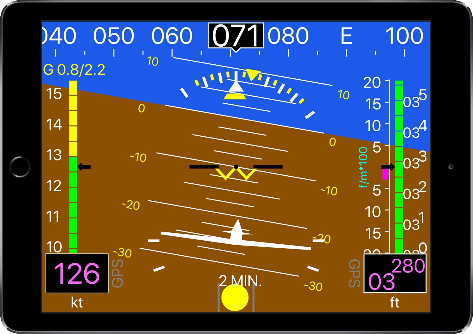
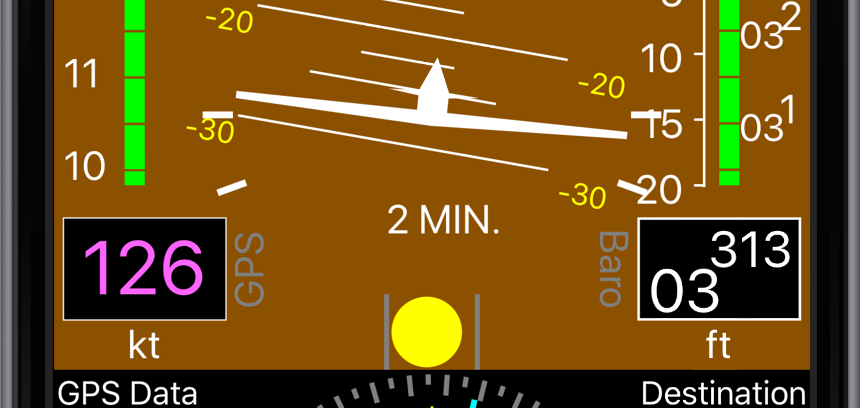
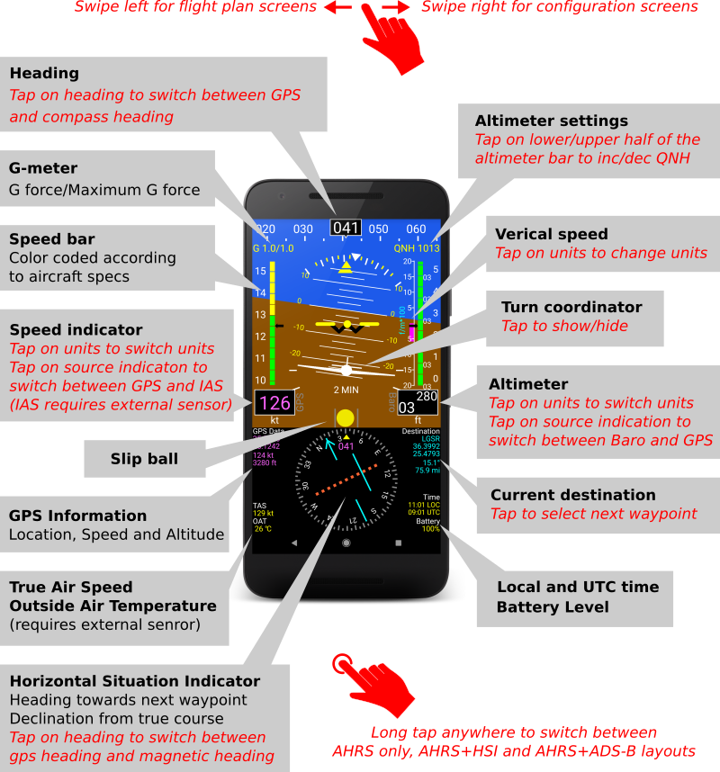
Attitude Indicator/Artificial Horizon (AHRS)
- Designed to stay accurate even during long turns and
heavy maneuvering.
- One-step, automatic leveling which can be performed easily after
mounting the phone or tablet on the cockpit.
- Option for manual leveling, if necessary (e.g. for tail draggers).
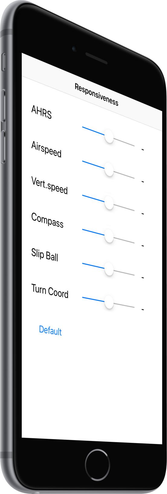
- Customizable damping factor to accommodate aircraft's normal vibrations.
|
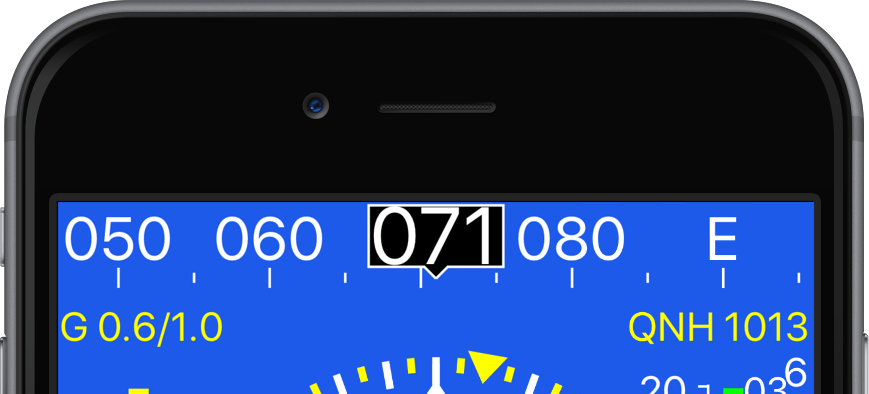
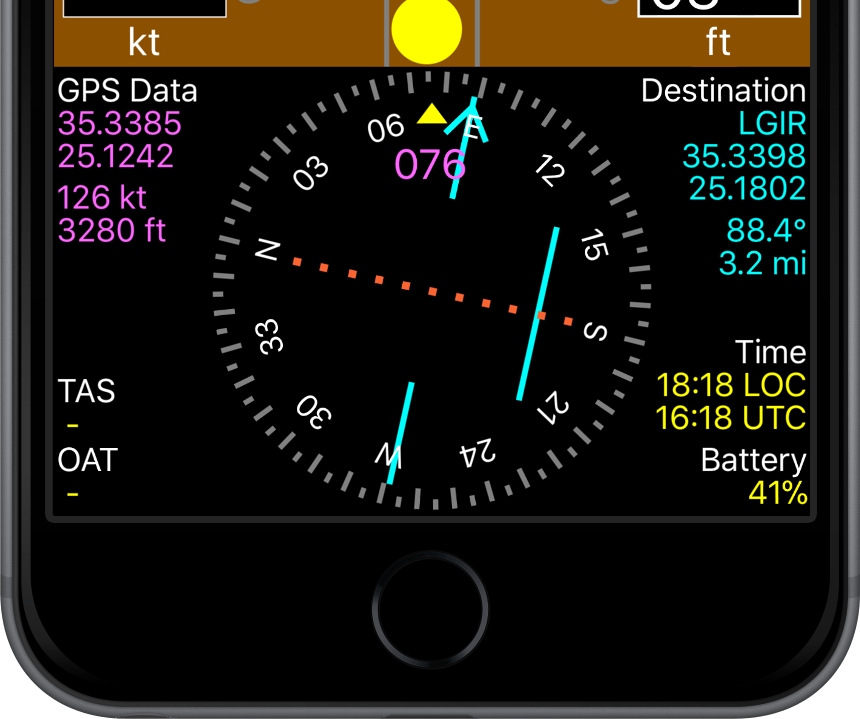
Heading indicator
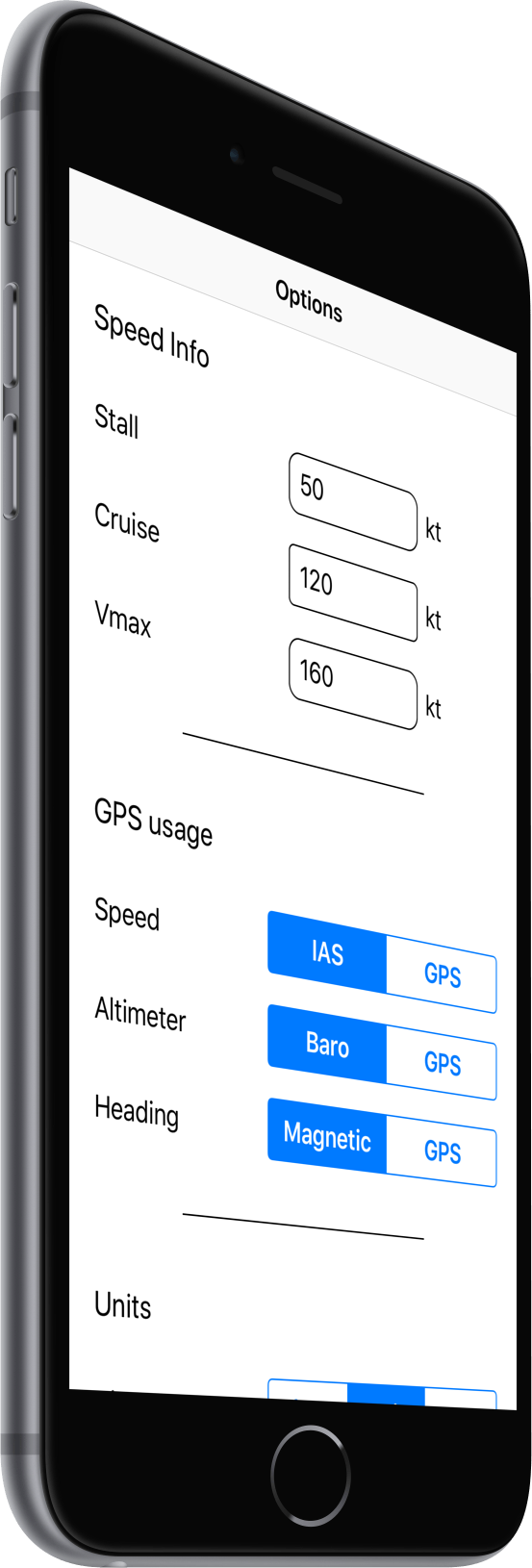
- Magnetic heading, computed using the internal magnetometers of the user's mobile device.
- True heading, computed using the GPS.
- Easy switching between magnetic and gps (true) heading by taping on the indication.
- Simple calibration procedure against local hard-iron and soft-iron
interference from magnetic field sources and ferromagnetic materials inside the cockpit.
|
|
|
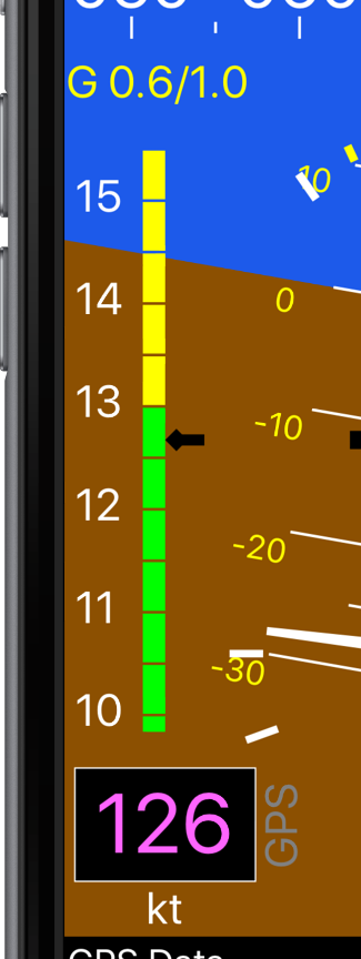
Ground speed indicator (GPS Speed)
- Numerical indication and linear gauge with standard green-yellow-red markings.
- Customizable stall (VS1), cruise (VNO) and never-exceed (NVE) speeds according to airplane's specifications.
- Audio warnings when approaching or exceeding stall speed or VNE.
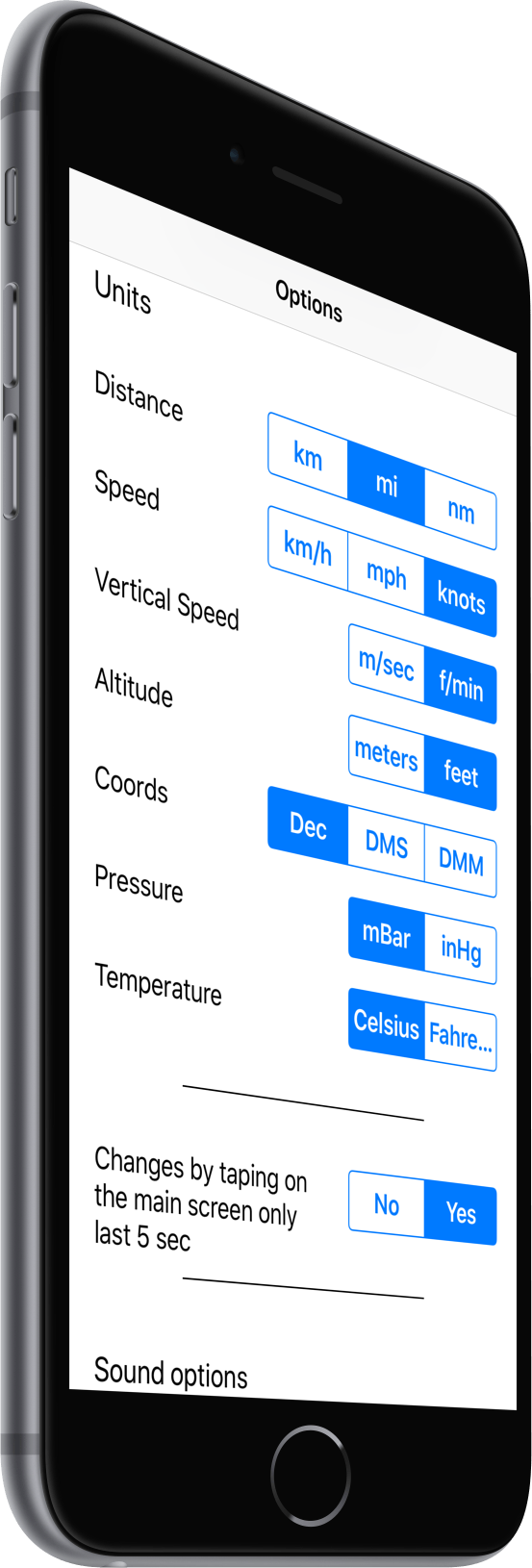
- Speed units can be switched to knots, km/h and mph by tapping on the unit indication.
- Indication for current and maximum G force.
|
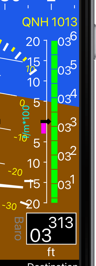
Altimeter and Vertical Speed
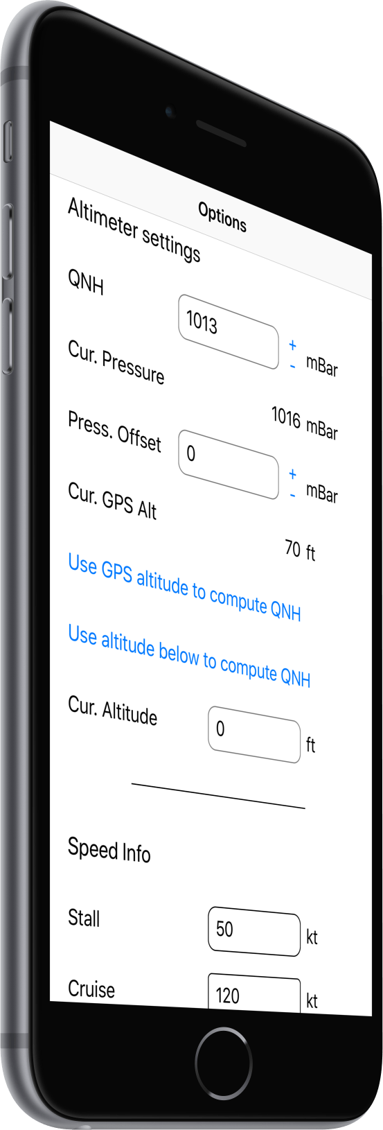
- Altitude/Vertical Speed can be computed either via barometric pressure (if pressure sensor is available on mobile phone) or GPS.
- Altitude/Vertical speed source switching between Baro and GPS by a simple tap on the relevant indication.
- Altitude units can be switched between ft and meter by taping on the relevant unit indication.
- Vertical speed units can be switched between ft/min and m/sec by taping on the relevant unit indication.
- Altimeter settings (QNH) can be easily changed with a few taps.
- Current altimeter setting is depicted for convenience above the altimeter gauge.
|
|
|
Turn Coordinator and Slip Indicator
- Turn coordinator with marks for the standard rate (2 min) turn.
- Slip (skid) indicator in the form of a slip ball with hash marks
at the center, indicating the plane is in a coordinated flight or not.
- Customizabkle damping for both the Turn Coordinator and the Slip Ball, according to airplane's vibration levels and/or pilot preference,.
|
Horizontal Situation Indicator (HSI)
- True course (via GPS) and magnetic course (via compass) to destination
- Rotary and numerical heading indication
- Course deviation bar
- Distance and bearing to destination
- HSI panel can be easily switched on and off by a long tap.
- Current destination can be selected by a single tap between the waypoints in the flight plan.
|
|


|
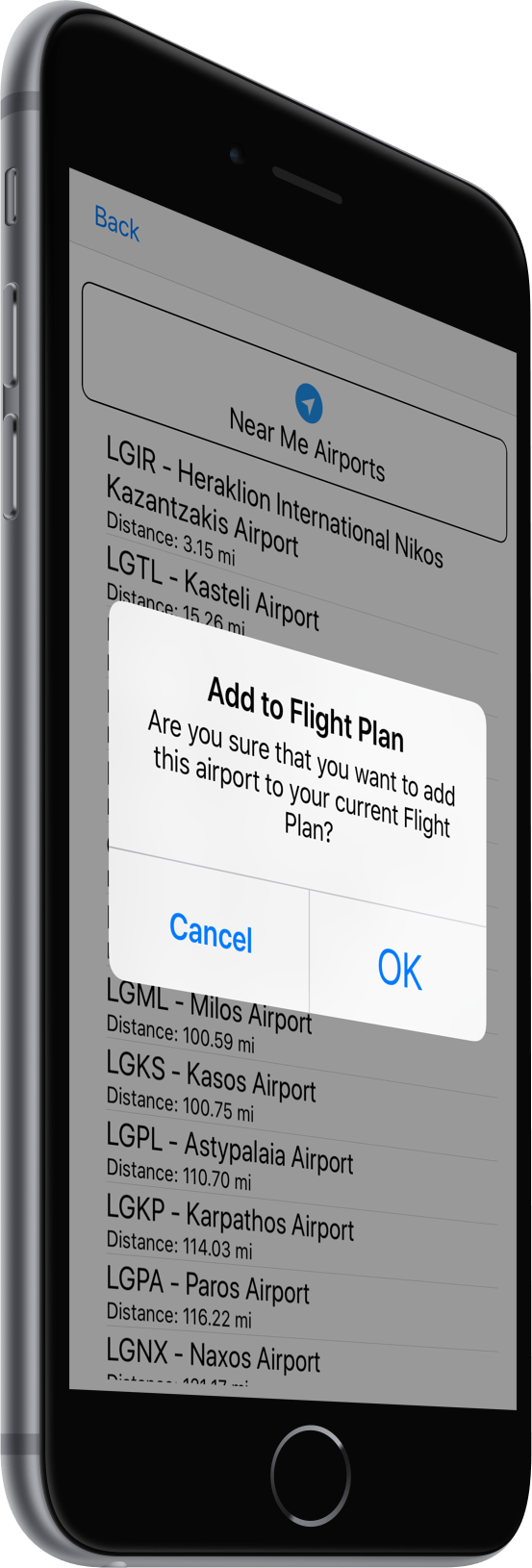
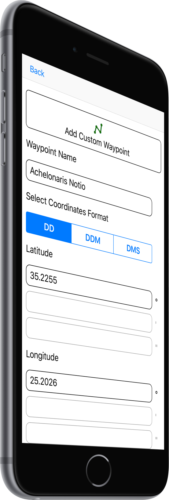
Flight Plan
- Flight plan defined as a set of way points.
- Waypoints can be selected by entering an airport code from a list of 37000 airports and airfields.
- Waypoints can be manually entered by means of coordinates.
- Simple schematic of flight plan with current position for visual verification.
|
Customizability
- Can run in portrait mode, in b>landscape mode, in reverse landscape mode, or, even, upside down (can be useful depending on the position of the charging adapter in the cockpit)!
- HSI screen can be turned off to save space if not needed.
- Can run in split screen (if the device supports this) to allow other apps to run simultaneously on the same device (e.g. moving map).
- Display theme support. Two black and white themes (free version) and two color themes are currently available.
- Tons of customization options make the app behave the way you need it to.
|
|
|
Powerful user interface
- Simple and intuitive, yet powerfull user interface.
- Everything is organized in a linear way and can be acessed simply by swiping left and right.
- Super easy adjustment of the altimeter settings from the main effis screen.
- Device orientation is determined automaticlly uppon startup.
- Easy switching between different display layouts by a long tap.
- Units of measurement for all displayed quantities can be toggled by a single tap. Then, after 5 sec, they return to their default settings automatically.
|
Important disclaimer
A-EFIS is not a certified aviation instrument. Do not rely on A-EFIS as your only navigation aid.
Failure to comply to this warning may result in property damage, serious injury or death. You assume total responsibility and risk associated with using this application.
The author of this software accepts no responsibility for damages resulting from the use of this product and makes no warranty or representation, either express or implied,
including but not limited to, any implied warranty of merchantability or fitness for a particular purpose. This software is provided "AS IS", and you, its user,
assume all risks when using it.